Rothera Point Orthomosaic 2026-04-02
- Collections
- Edition
- 1
- Published
- Access
- Restricted
Produced by British Antarctic Survey, 2026, https://data.bas.ac.uk/items/3ea32bb4-06ed-4462-bcb2-26b0171636d2.
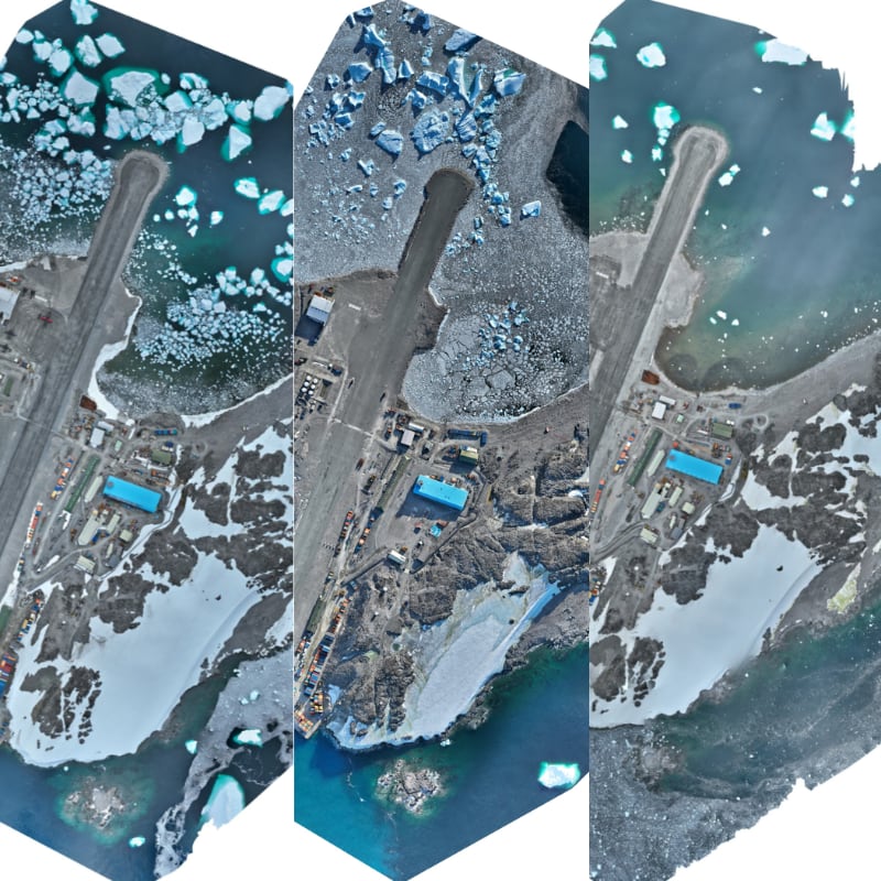
Orthomosaic of Rothera Point derived from UAV imagery acquired by the BAS Engineering Team for site progress recording and general visual reference.
Warning
This item is not a survey-grade output and has known positional accuracy limitations.
Further details on acquisition, processing, data quality and restrictions on use are provided in the Lineage.
Tip
For any use requiring reliable positional accuracy, users should refer to the latest Minimum Snow Cover (MSC) dataset.
This item includes two image files:
- a non-georeferenced and reduced resolution quick-look JPEG
- CDE reference:
AIMP-BAS-ZZZ-XX-I-Y-0011
- CDE reference:
- a georeferenced GeoTIFF for qualitative visual reference and progress inspection
- CDE reference:
AIMP-BAS-ZZZ-XX-I-Y-0012
- CDE reference:
A new edition of this item is available
Please see Rothera Point Orthomosaic 2026-05-26.