Rothera Point Orthomosaic 2026-05-26
- Collections
- Edition
- 1
- Published
- Access
- Restricted
Produced by British Antarctic Survey, 2026, https://data.bas.ac.uk/items/75a43e71-f69e-4c7e-91c2-9f0b10dc4ee5.
Orthomosaic of Rothera Point derived from UAV imagery acquired by the BAS Engineering Team for site progress recording and general visual reference.
Warning
This item is not a survey-grade output and has known positional accuracy limitations.
Further details on acquisition, processing, data quality and restrictions on use are provided in the Lineage.
Tip
For any use requiring reliable positional accuracy, users should refer to the latest Minimum Snow Cover (MSC) dataset.
Add this item to a desktop or online GIS that supports ArcGIS Raster (Map) Tiles External link, opens in a new window..
- Service Endpoint
https://utility.arcgis.com/usrsvcs/servers/d621049d675b4d1bb270e790fa0e8121/rest/services/bas_san_magic_airphoto/engineering_rothera_orthomosaic_2026_05_26/MapServer

This is a licence summary, see the Formal Licence External link, opens in a new window. for more information.
Bounding Coordinates
- South-West Corner (min x/y)
- South: -67.572222, West: -68.1333
- North-East Corner (max x/y)
- North: -67.563889, East: -68.1111
Temporal Range
- Start
- End
Lineage Statement
The orthomosaic was generated from UAV imagery captured by the BAS Engineering Team at Rothera Research Station.
Instrumentation
UAV model:
- DJI Mavic 3 Enterprise
Camera specification:
- Sensor: 4/3 CMOS, 20 MP effective pixels
- Lens field of view: 84°
- Equivalent focal length: 24 mm
- Aperture: f/2.8–f/11
- Focus range: 1 m to infinity
- ISO range: 100–6400
- Electronic shutter speed: 8–1/8000 s
- Mechanical shutter speed: 8–1/2000 s
- Maximum image size: 5280 × 3956 pixels
Data processing and accuracy
The orthomosaic was produced through photogrammetric processing of the UAV imagery and exported in the UTM Zone 19S coordinate system.
No surveyed Ground Control Points were used during the processing. The dataset was therefore georeferenced using the UAV’s internal positional information only.
No independent accuracy assessment was undertaken; therefore, the positional accuracy of the dataset has not been independently verified. As the imagery was not acquired or processed for accurate mapping or survey purposes, no Ground Sampling Distance (GSD) has been specified, and no photogrammetric processing or accuracy report is available for this item.
Warning
This orthomosaic is intended for visual reference, site awareness, and general progress-record purposes only.
It should not be used for precise measurement, setting out, design verification, engineering assessment, asset positioning, boundary definition, or any other survey-grade application.
Tip
Any use requiring reliable spatial accuracy should refer to the Minimum Snow Cover (MSC) dataset survey.
Replaces
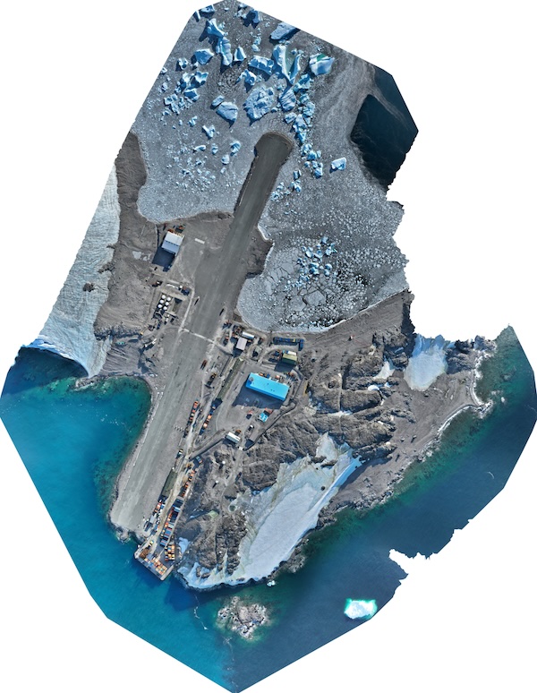
Orthomosaic of Rothera Point, derived from UAV imagery captured 2nd April 2026.
Part of these collections
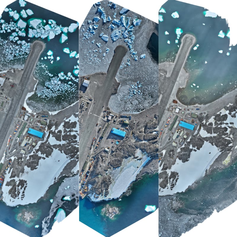
A collection of UAV-derived orthomosaics of Rothera Point acquired by the BAS Engineering Team for site progress monitoring and general visual reference.
Item Information
- Item ID
- 75a43e71-f69e-4c7e-91c2-9f0b10dc4ee5
- Item Type
- PRODUCT
- Item edition
- 1
- Item Created
- Item Published
- Item Released
- Item Status
- Item is complete and recommended for general use
- Item Update Frequency
- Item may be updated if needed
Metadata Information
- Last updated
- Metadata Standard
- ISO 19115-2 Geographic Information - Metadata - Part 2: Extensions for Imagery and Gridded Data
- Metadata Standard Version
- ISO 19115-2:2009(E)
- Metadata Profiles
- British Antarctic Survey (BAS) Mapping and Geographic Information Centre (MAGIC) Discovery Metadata Profile (v2) External link, opens in a new window.
- British Antarctic Survey (BAS) Mapping and Geographic Information Centre (MAGIC) Administration Metadata Profile (v1) External link, opens in a new window.
- Metadata Licence
- Creative Commons Attribution-NoDerivatives 4.0 International External link, opens in a new window.
- Metadata Links
- Item page build time
Alternative contact methods
By post
British Antarctic SurveyHigh Cross
Madingley Road
Cambridge
Cambridgeshire
CB3 0ET
United Kingdom
By phone
By email
Privacy Notice
If you contact us, your personal information will be retained for up to three years and then deleted. It will only be used to contact you regarding your enquiry. If this item relates to an external organisation, we may share an anonymised version of your enquiry with them to help answer your query.
We use Cloudflare Turnstile, a third-party service, to protect against spam enquires.
See our privacy policy for more information.