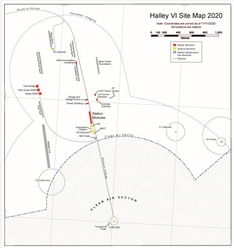
Halley VI Site Map
- Collections
- Edition
- 2
- Published
- Access
- Restricted
Produced by the Mapping and Geographic Information Centre, British Antarctic Survey, 2026, version 2, https://data.bas.ac.uk/maps/2061.
Map of Halley VIa Research Station, showing locations of station structures, infrastructure assets, comms lines, clean air zone and flagline perimeter. Data and locations correct as of 12/08/2026. All locations are relative.
Projection: WGS84 UTM Zone 26S
Data sources and references can be found in the lineage
Halley VI Research Station is located on a moving ice shelf.
As a result, the coordinates shown on this map are accurate as of 12 August 2026 only. The station's position will continue to change after this date, and the coordinates shown will no longer be correct.