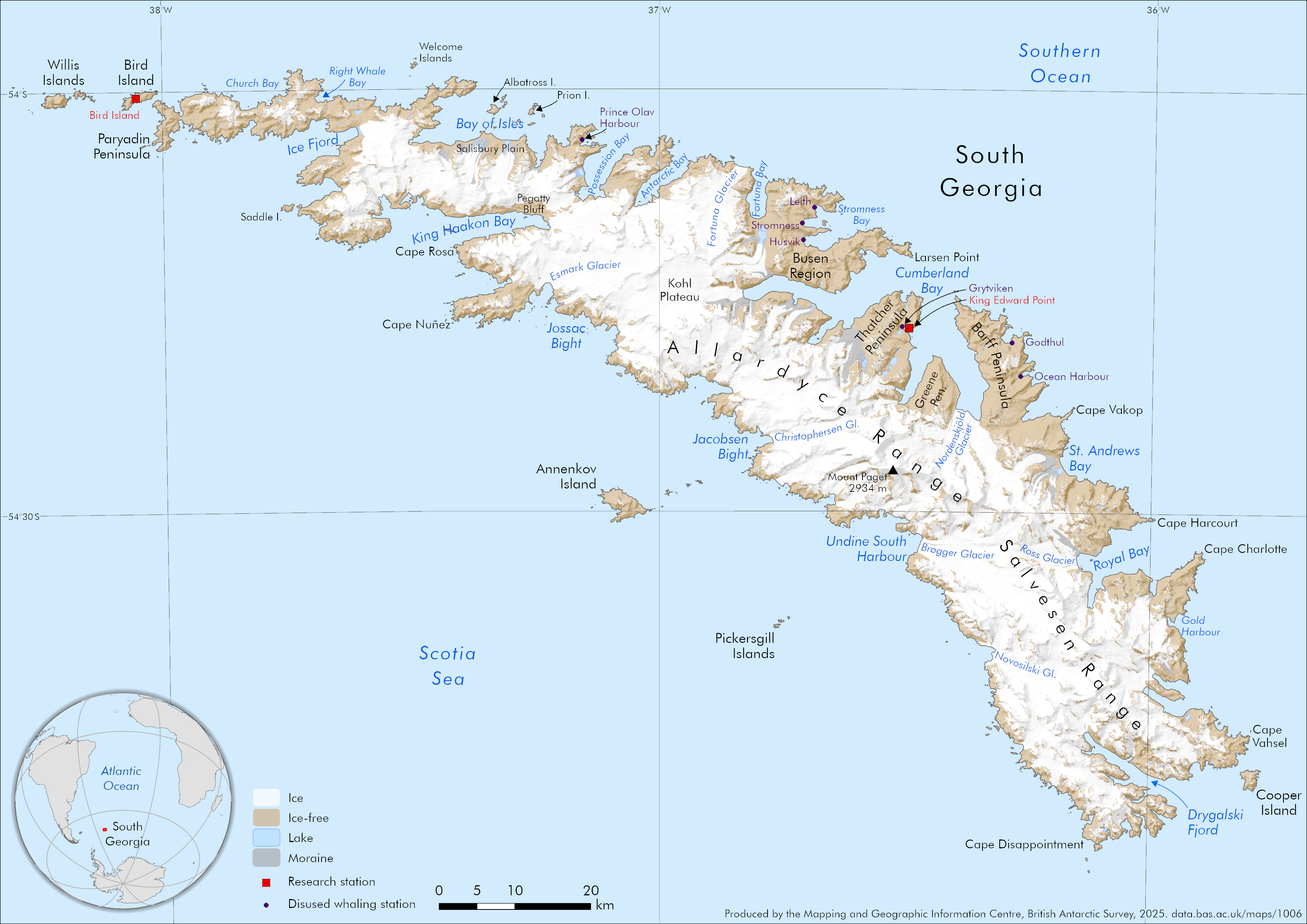
An A4 overview map of South Georgia
- Collections
- Edition
- 1
- Published
Produced by the Mapping and Geographic Information Centre, British Antarctic Survey, 2025, version 1, https://data.bas.ac.uk/maps/1006.
An A4 map of the island of South Georgia in the Southern Ocean. The map includes land cover split into ice and ice-free ground, moraine and lakes. The locations of disused whaling stations are shown, as well as the location of two current research stations. The tallest mountain (Mount Paget) is shown on the map, alongside selected place names. A small inset map is displayed in the corner, indicating South Georgia's location within the wider South Atlantic region.
Map projection: WGS84 South Georgia Lambert, EPSG 3762.
Data sources and references can be found in the lineage.