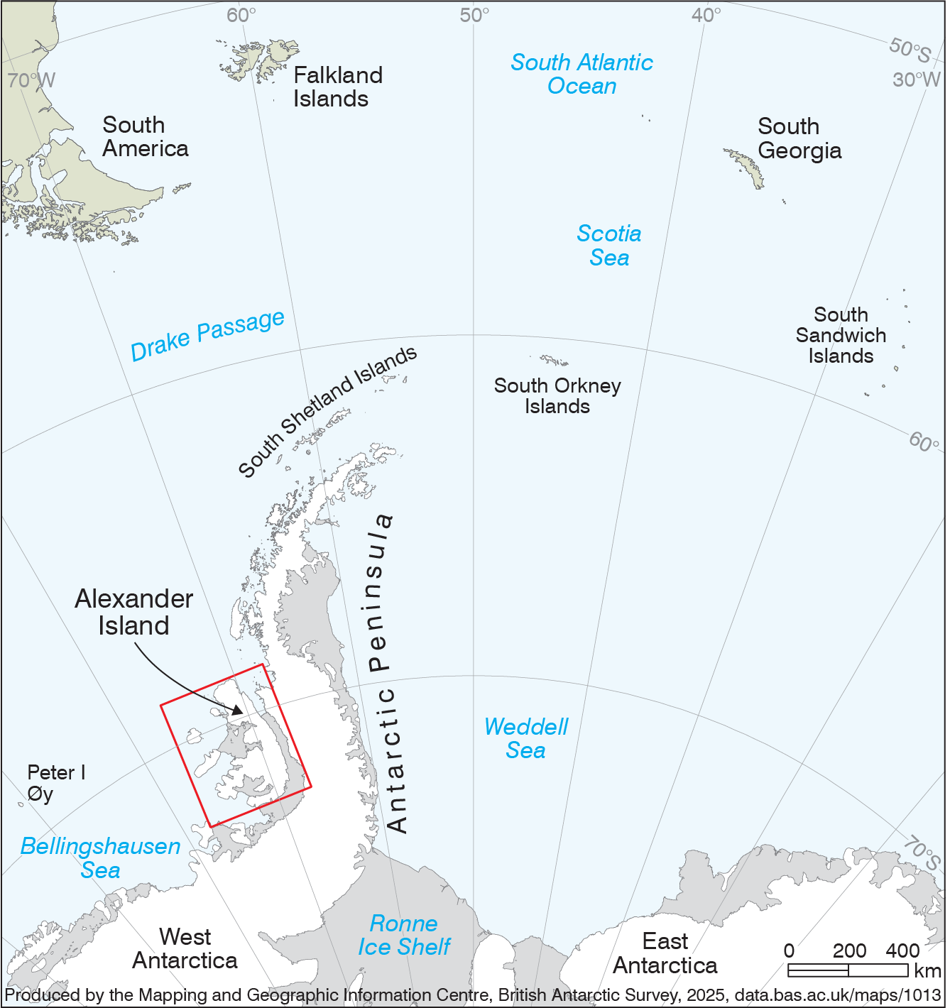
Alexander Island location map
- Collections
- Edition
- 1
- Published
Produced by the Mapping and Geographic Information Centre, British Antarctic Survey, 2025, version 1, https://data.bas.ac.uk/maps/1013.
A small map indicating the location of Alexander Island within the wider Antarctica/South America region. The map covers the south-west tip of South America, Falkland Islands, South Georgia and the South Sandwich Islands, South Orkney Islands, South Shetland Islands, Antarctic Peninsula and the Ronne Ice Shelf.
The map shows the extent of and is an extract from the "British Antarctic Survey, 2025. Alexander Island, 1:500 000 scale map. BAS Topographic Series, Sheet 4, Edition 1. Cambridge, British Antarctic Survey." - data.bas.ac.uk/maps/topo4