Falkland Islands overview map
- Collections
- Edition
- 1
- Published
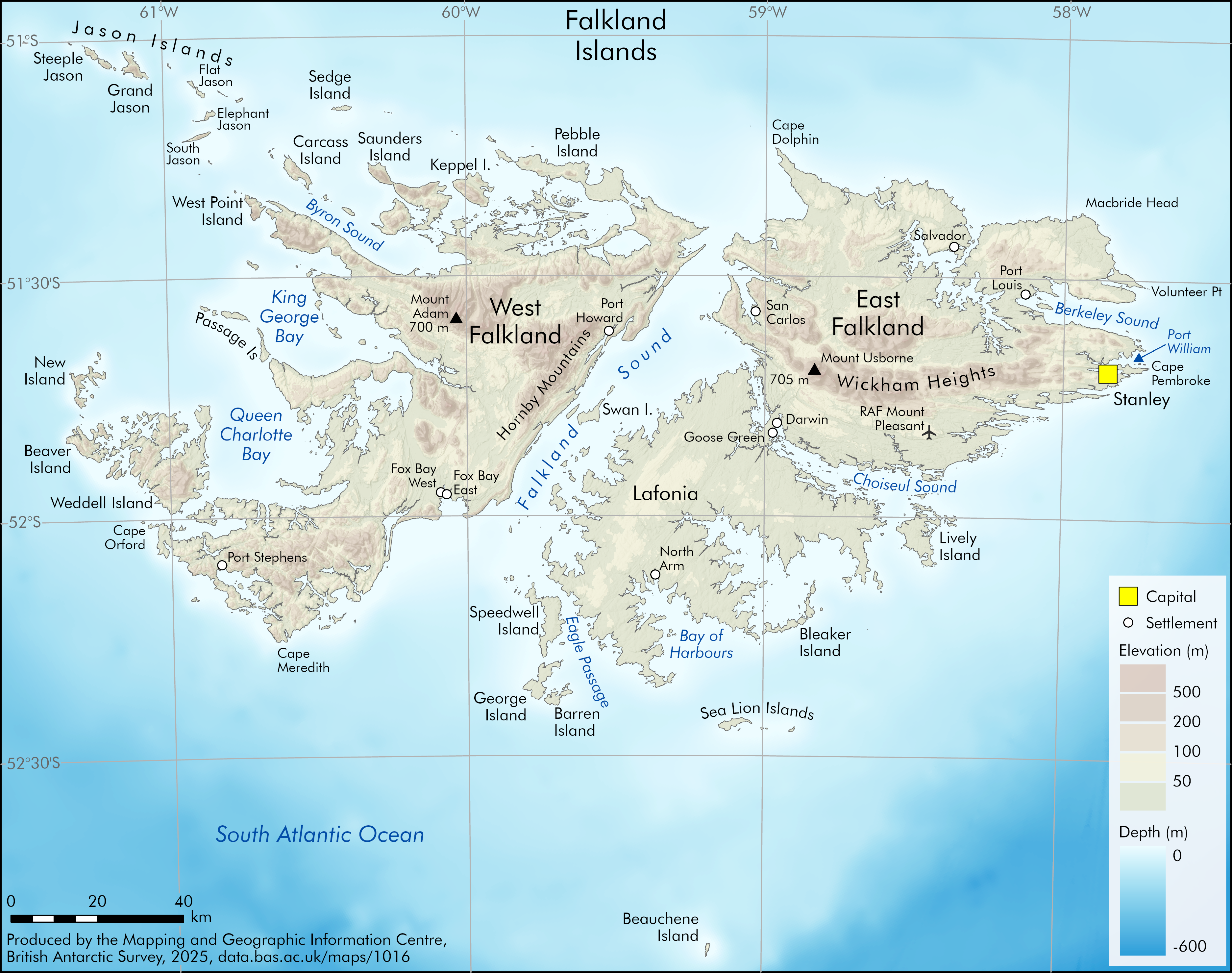
Produced by the Mapping and Geographic Information Centre, British Antarctic Survey, 2025, version 1, https://data.bas.ac.uk/maps/1016.
An overview map of the Falkland Islands, showing key place names, settlements and elevation. The map shows elevation with a tinted shaded relief, and the highest mountains on East and West Falkland Islands are displayed. The capital city, Stanley, is shown, along with further settlements.
Map projection: WGS84 UTM Zone 21S, Central Meridian 59°30'W.
Data sources and references can be found in the lineage.