Field Map - REWIND
- Collections
- Edition
- 1
- Published
- Access
- Restricted
Produced by the Mapping and Geographic Information Centre, British Antarctic Survey, 2025, version 1, https://data.bas.ac.uk/maps/2058.
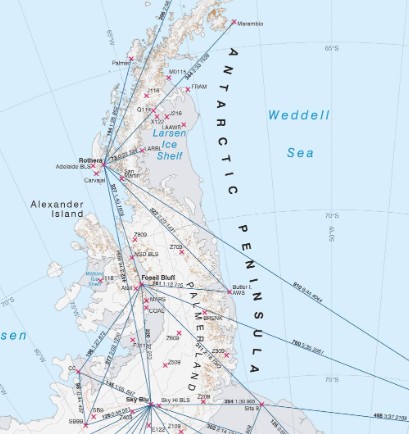
Map of Palmer Land region from Staack Nunataks to Grossman Nunataks showing planned study sites for the REWIND project. Mapped over the Esri WorldImagery basemap. Contours are shown at 100 m intervals and spot heights are shown in metres and feet. For use in operations planning during the 2025-26 operational season.
Projection: WGS84 Antarctic Polar Stereographic, Central Meridian 72°W. Vertical Datum EGM08.
Data sources and references can be found in the lineage.