Greenland Basal Topography - Side A
- One side of
- Greenland Basal Topography
- Edition
- 1
- Published
British Antarctic Survey, 2017. Greenland Basal Topography - Side A, 1:3,500,000 scale map. BAS Thematic Map Series, Sheet 2A, Edition 1. Cambridge, British Antarctic Survey.
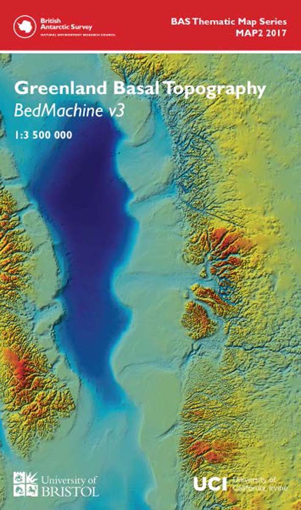
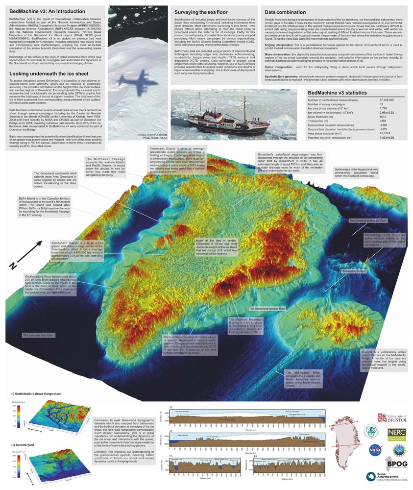
This is side A of a double-sided map. This geophysical and glaciological map shows the basal topography of Greenland and surrounding seabed. The topography of the subglacial landscape under the Greenland Icesheet was modelled using a mixture of radio echo-sounding and a glaciological model (BEDMACHINE 2) and is presented in a similar colour scheme to the Antarctic BEDMAP2.
The map is a result of a collaboration between British Antarctic Survey and Bristol University, based on data from a joint project between Bristol University and the University of Irvine California.
This side shows a detailed map, in plan view, and includes important place names, coastline and the 0 metre contour.